This website uses cookies, only for statistical purposes. They allow us to know the visits to our website, and the content that interests you. Learn more
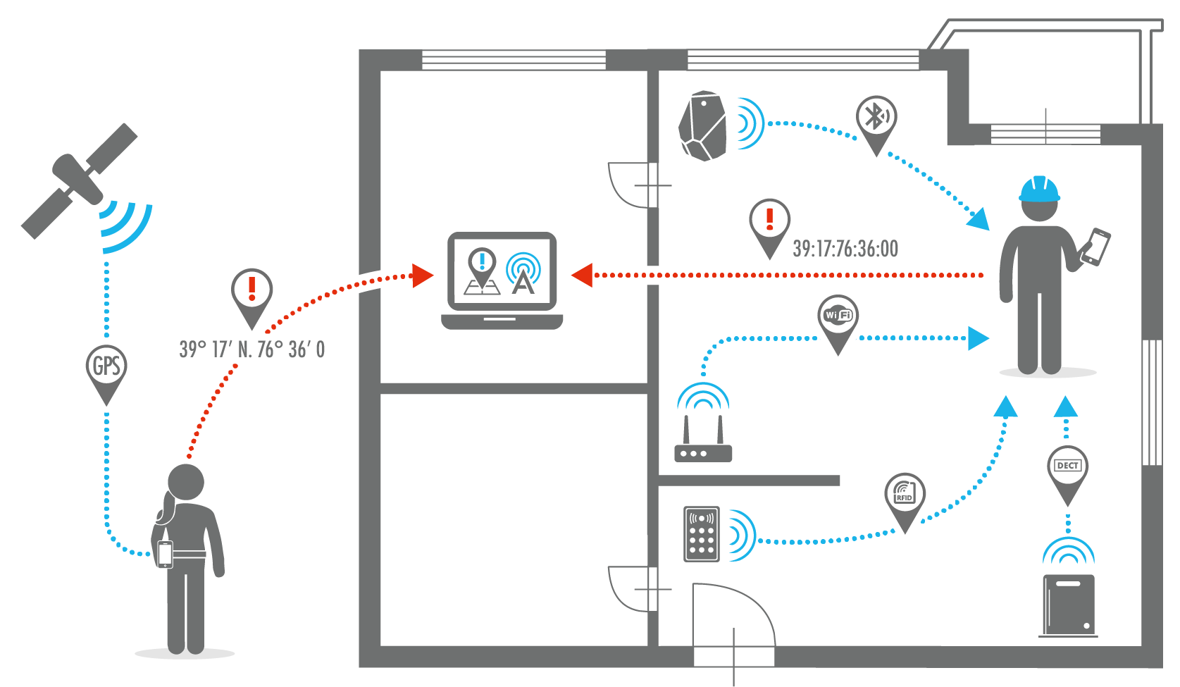
Static geolocation
ALERT can determine the location of all the alarms in your facility.
Alarms can be geolocated individually and collectively according to the principle of zones.
Zones are represented on the map as an outline of a room, building, sector, and so on, and several alarms may be associated with the zone. When an alarm is triggered, the associated zone is displayed on the map in red.